


GREarth can apply precipitation typing to both the raw and QC radar data for display. The GREarth server generates a new precipitation type data field every five minutes by interpolating the RUC 13km model output. The algorithm is based on the Canadian "Energy" method that has been modified to produce probabilities for rain, freezing rain, sleet, and snow. These probabilities are combined with the radar mosaic in a novel rendering technique to show mixtures of types in real time. Here is an example showing all the precip types overlaid with METAR Present Weather icons:
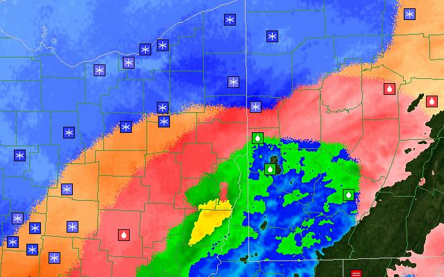
The large blue area in the upper-left is all snow, the orange areas are sleet, red areas indicate freezing rain, and the regular reflectivity color area is all rain. At the current time, the precipitation typing algorithm is completely dependent on the accuracy of the RUC model.
